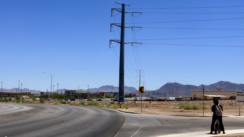
Cross Russell Road from Henderson into ZIP code 89122 and the infrastructure changes. The separated raised bike lanes, maintained sidewalks, and paved road surfaces that Henderson has built as a matter of policy give way to painted stripes on crumbling asphalt, broken concrete, dirt shoulders, and paths that simply stop. The line is a city limit. What it marks is a decade of divergent decisions about who deserves to move safely.
Russell Road runs east-west across the Las Vegas Valley. It is, in much of its eastern stretch, a jurisdictional boundary. South of Russell Road, the City of Henderson begins. North of it, in ZIP code 89122, Clark County’s unincorporated Whitney community continues.
The difference does not announce itself with a sign. It announces itself with the road.
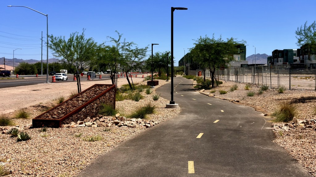
On the Henderson side of that line, the city has built and is expanding a network of more than 300 miles of trails, bike lanes, and paths governed by a Master Bicycle and Trail Plan, maintained by a dedicated public works department, and backed by a comprehensive plan that names bicycle infrastructure as a mobility right for residents. The U.S. Department of Transportation recognized Henderson in its Mayors’ Challenge program specifically for the design and construction of separated raised bike lanes, a standard of cycling infrastructure that physically elevates the bike surface above the traffic lane and buffers it from moving vehicles.
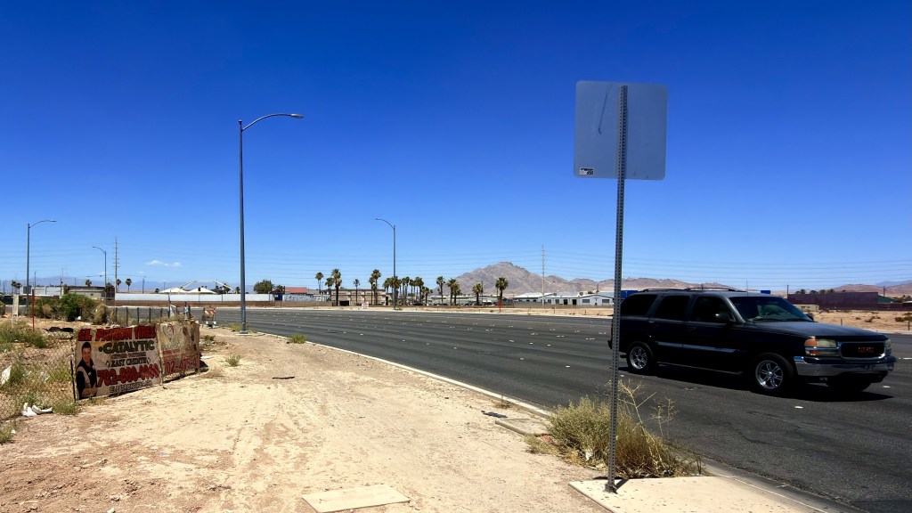
On the Clark County side, in the community of Whitney that makes up much of ZIP code 89122, Clark County Public Works maintains its own list of what it is responsible for. That list, published on the department’s own website, includes, without qualification, roadways both paved and gravel, gravel shoulders, and asphalt paths alongside concrete sidewalks, curb and gutter, and ADA ramps.
Gravel roads and gravel shoulders are official infrastructure categories in Clark County’s maintenance inventory. They are not anomalies. They are a designated standard.

Help fund our archive
Sliding scale $3.00-$8.00

Keep the lights on
Sliding scale $3.00-$8.00
Who Lives Here
ZIP code 89122 covers approximately 9.5 square miles in the eastern Las Vegas Valley. According to the U.S. Census Bureau American Community Survey 2023 five-year estimates, the ZIP code has a population of approximately 51,567 to 55,121 people, depending on the estimate period.
The community is predominantly working class and majority minority. The largest demographic group is Hispanic or Latino at 41.7 percent of the population. White non-Hispanic residents account for 41.5 percent. Mexican ancestry is the most common reported ancestry at 28.7 percent of residents. Korean ancestry accounts for 10.9 percent. Central American ancestry accounts for 5.3 percent. Immigrant communities from Latin America and Southeast Asia are significantly represented.
The median household income in 89122 is $55,216 to $60,357 across different Census estimate methodologies. The Clark County median household income is $73,845. The Henderson city median household income is $88,654. The poverty rate in 89122 is 14.8 percent, according to Census Reporter’s analysis of ACS data, approximately 10 percent higher than the Las Vegas metro area rate and 20 percent higher than the national rate.
Nineteen percent of households in 89122 receive SNAP benefits. Thirty-six percent receive Social Security income, suggesting a substantial retiree or disability population. College educational attainment is 17 percent, below the national average, consistent with a trades and service-sector workforce.
The dominant employment sector is service, with arts, entertainment, and food service as the leading industry. The average commute is 28.8 minutes, approximately 20 percent higher than the regional average, suggesting lower rates of vehicle access and greater dependence on transit and active transportation.
These are the people for whom bike lanes are not recreational amenities. They are transportation infrastructure. A broken bike lane or a dirt shoulder is not an inconvenience for someone who owns a car and uses the bike path on weekends. For a worker who rides to a bus stop, it is a safety emergency on a daily schedule.
What a Legal Bike Lane Requires
Nevada law and federal standards define what constitutes a designated bicycle lane. According to NDOT’s published bicycle FAQ, a designated bike lane must be assigned by striping, signs, and pavement markings. It must include a rider on a bicycle stencil. It must meet minimum federal width criteria of at least four feet.
The RTC’s Southern Nevada bicycle map standards further distinguish between three levels of cycling infrastructure. A bicycle lane is a striped and marked portion of the roadway. A bicycle route is a shared roadway signed as preferred for cyclists, with a minimum curb lane width of 14 feet. A bicycle compatible street has at least 14 feet between the lane line and the curb to accommodate shared travel.
Henderson operates above these minimum standards. The U.S. DOT Mayors’ Challenge evaluation of Henderson’s infrastructure specifically cites the separated raised bike lane as the city’s design standard, a facility type that goes beyond the federal minimum by physically elevating the cycling surface and providing a buffer from motor vehicle traffic. Henderson’s Reimagine Boulder Highway project, currently under construction through 2027, is adding elevated buffered bike lanes along the full 7.5-mile corridor.
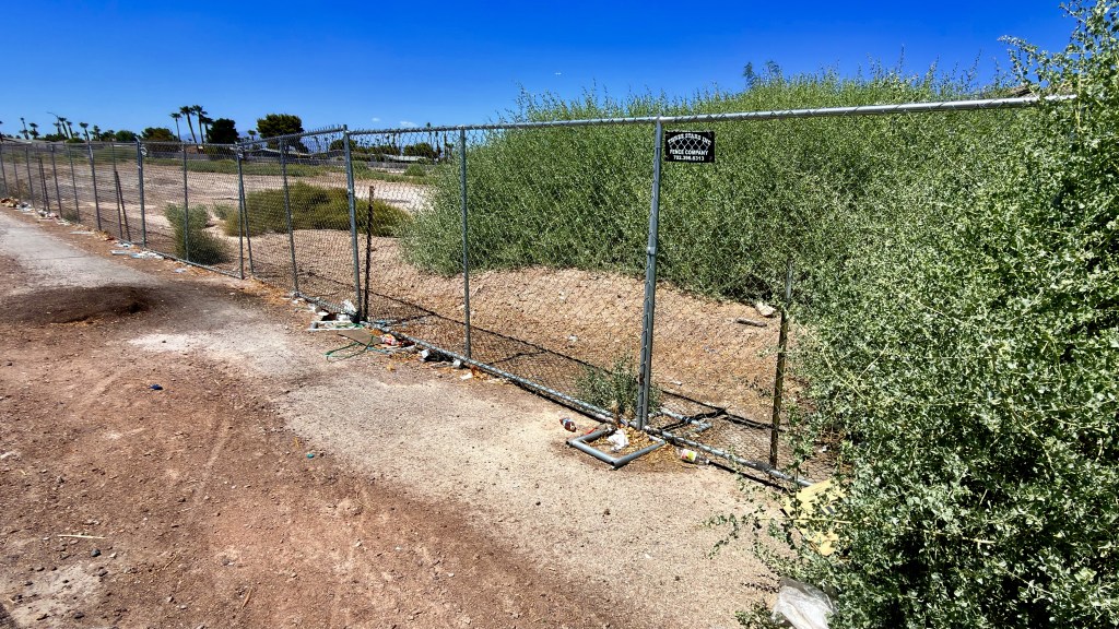
The standard in 89122 is not elevated. Where bike lanes exist at all, they are painted stripes. A stripe on deteriorating asphalt is a legal bike lane by minimum definition. It is not a safe cycling surface. And a stripe that ends at a crumbling curb cut, transitions to broken concrete sidewalk, or simply disappears into a dirt shoulder is not even that.
The Russell Road Line
Russell Road is not the only boundary where the infrastructure diverges. It is the most immediate and the most visible. The streets that feed into the Russell Road corridor from the north, within 89122, include residential collectors and local streets that were built without continuous sidewalks, without bike lanes, and without the curb and gutter systems that define Henderson’s street standards.
Clark County’s own Public Works department is responsible for the streets in Whitney and the portions of Sunrise Manor that overlap with 89122. The department’s mandate includes maintenance of gravel shoulders explicitly. That designation means that where a paved shoulder or bike lane does not exist, the county’s answer can be a graded dirt surface. In Henderson, that answer does not exist. The City of Henderson’s street design standards require curb, gutter, and sidewalk on all collector and arterial roads.
The practical result, visible on the ground, is a condition where a cyclist crossing from Henderson into 89122 may encounter the following in rapid succession: a separated raised bike lane transitioning to a standard painted bike lane, then to a shared lane marking, then to no lane designation at all, then to a broken sidewalk, then to a dirt shoulder, then to nothing.
That sequence is not the result of temporary construction or deferred maintenance on a single block. It is the cumulative product of two different jurisdictions operating under two different infrastructure standards with two different levels of capital investment applied over decades.
How Henderson Got Here
Henderson’s cycling infrastructure did not emerge organically. It was built through deliberate policy, sustained capital commitment, and successful federal grant applications over more than a decade.
The city’s Master Bicycle and Trail Plan governs the development and maintenance of its entire trail network. The plan identifies specific routes, sets design standards, and establishes connectivity goals that link neighborhoods to parks, transit, schools, and commercial areas. It is a governing document with budget implications. It exists because the city created it and funds it.
The Reimagine Boulder Highway project, funded by a $39.9 million federal INFRA grant secured through the U.S. Department of Transportation and supplemented by Regional Transportation Commission allocations, is spending $184 million to rebuild Henderson’s portion of Boulder Highway with elevated bike lanes on both sides of the full 7.5-mile corridor, center-running bus rapid transit, improved lighting, widened sidewalks, and drainage upgrades. Construction runs through July 2027.
Henderson is also currently expanding the Nevada State Drive corridor with bike lanes, replacing sidewalks, and improving traffic signals as part of a separate city-funded project that began in June 2024. Its I-215 widening project, running from Q1 2025 through Q1 2027, is adding a pedestrian bridge over Green Valley Parkway and upgrading multiple interchange points. The city is conducting the Lake Mead Parkway Corridor Study, covering 8.4 miles, to assess cycling and walking improvements alongside vehicle travel.
Henderson’s own published project list as of May 2026 includes ongoing and planned improvements to Magic Way pavement, Mohawk Drive traffic calming, multiple roundabout installations, and corridor safety studies. These are not extraordinary projects. They are the routine output of a city with a dedicated public works department, a comprehensive plan, and the institutional capacity to apply for federal infrastructure grants and execute them.
What Clark County Has and Has Not Done
Clark County Public Works manages a Capital Improvement Program described on its own website as approximately $3 billion. That program covers the entirety of unincorporated Clark County, which encompasses more than 300 square miles of the Las Vegas Valley including Whitney, Sunrise Manor, Enterprise, Spring Valley, and other communities with hundreds of thousands of residents.
The department’s own list of maintenance responsibilities includes gravel roads and gravel shoulders alongside paved roadways, concrete sidewalks, asphalt paths, and ADA ramps. That the department must maintain gravel infrastructure at all, in an urban Las Vegas Valley community in 2026, is itself a data point. Gravel roads are a legacy condition from when the eastern valley was subdivided before paving standards were applied. They have not been fully addressed in communities like Whitney in the decades since.
The RTC’s Transportation Improvement Program for 2025-2029, which governs federally funded projects across the region, lists projects throughout the valley. The Russell Road corridor appears in the document in the context of high-traffic intersection improvements, not cycling infrastructure. No separated bike lane project for the 89122 portion of the corridor appears in the 2025-2029 programming cycle.
The Whitney community plan, maintained by Clark County’s Comprehensive Planning Department, covers 26,240 acres and 22 square miles of the eastern valley. Whitney is administered as an unincorporated town with a Town Advisory Board that has no governing authority. It cannot bond, levy taxes, or apply directly to federal grant programs. Its infrastructure is funded through Clark County’s general capital program, competing against every other unincorporated community in a county that covers more than 7,900 square miles in total.

Your support keeps this work going

3×3 Vinyl Sticker
Sliding scale $3.00-$8.00
What Federal Standards Require and What Gets Applied
Federal law under 49 CFR Part 26 requires agencies receiving U.S. DOT funding to implement Disadvantaged Business Enterprise programs and to ensure that DBE firms have opportunities to participate in federally funded contracts. Federal accessibility law under the Americans with Disabilities Act requires that sidewalks and curb ramps in the public right of way meet ADA standards wherever public funds are spent on road improvements.
Clark County’s own 2026 ADA Curb Ramp Improvement Project is retrofitting 66 ramps in compliance with state and federal ADA regulations, specifically as triggered by the 2026 Hot Mix Overlay paving project. The language is precise. The ADA upgrades are being triggered by a paving project. They are not proactive. They are reactive, required by law when another project touches the right of way. Without the paving project, the ramps might not be addressed.
That compliance-triggered model is the dominant mode of sidewalk and accessibility improvement in Clark County unincorporated communities. Infrastructure is upgraded when a project requires it. It is not upgraded because a community’s residents lack it.
Henderson operates differently. Its comprehensive plan requires that new development meet bicycle and pedestrian infrastructure standards as a condition of approval. Its capital improvement program funds proactive street rehabilitation that includes sidewalk, curb, gutter, and bike lane improvements as part of the scope, not as a compliance afterthought. The difference in outcomes on the ground is the difference between two planning philosophies applied over two decades.
The People Carrying the Cost
The 51,567 residents of ZIP code 89122 have a median commute of 28.8 minutes, 20 percent longer than the regional average. That gap is not explained by distance alone. It reflects lower rates of vehicle access, greater dependence on transit, and the additional time burden of navigating infrastructure that was not built for them.
A resident of 89122 who rides a bicycle to a bus stop on a collector road in Whitney is riding on a surface that may be a stripe on deteriorating asphalt, a broken sidewalk that is legally usable by cyclists under Nevada law when no bike lane exists, or a gravel shoulder. At the point where the road crosses into Henderson, that same rider enters a jurisdiction that has received federal recognition for the quality of its cycling infrastructure.
The median household income difference between 89122 and Henderson is approximately $33,000 per year. The poverty rate in 89122 is 14.8 percent. The poverty rate in Henderson is significantly lower. These are not coincidental relationships. Lower-income communities are more dependent on active transportation and less able to absorb the physical risks and time costs of inadequate infrastructure. They are also less able to organize the kind of political advocacy that produces federal grant applications and comprehensive planning documents.
Henderson’s cycling infrastructure exists because Henderson’s residents, its city council, and its planning staff built the institutional case for it over years and secured the federal funding to execute it. That process requires capacity. Whitney’s residents have a Town Advisory Board with no governing authority and a planning process that routes through the Clark County Commission, which governs more than 300 square miles of competing priorities.
The infrastructure gap between one side of Russell Road and the other is not a mystery. It is the physical accumulation of that difference in capacity, applied over time, written in pavement and dirt.
Sources: U.S. Census Bureau American Community Survey 2023 5-year estimates / Census Reporter profile for ZIP 89122; Zip Atlas 89122 demographic profile; IncomebyzipCode.com 89122 vs Henderson comparison; Clark County Public Works Department website (clarkcountynv.gov/public_works); Clark County Comprehensive Planning / Whitney community page; Clark County Comprehensive Planning / Sunrise Manor page; Henderson Maps & Trails page (cityofhenderson.com); U.S. Department of Transportation Mayors’ Challenge / Henderson evaluation document (transportation.gov); Henderson Current Projects page (cityofhenderson.com); Henderson Boulder Highway Initiatives page (cityofhenderson.com); NDOT Bicycle FAQ document (dot.nv.gov); RTC Southern Nevada Bicycle Maps page (rtcsnv.com); RTC Transportation Improvement Program 2025-2029 Appendix A1; RTC Regional Transportation Plan 2025-2050 Appendix A2; Clark County 2026 ADA Curb Ramp Improvement Project (clarkcountynv.gov); 49 CFR Part 26; Americans with Disabilities Act Title II.
Discover more from KVIG Informative
Subscribe to get the latest posts sent to your email.